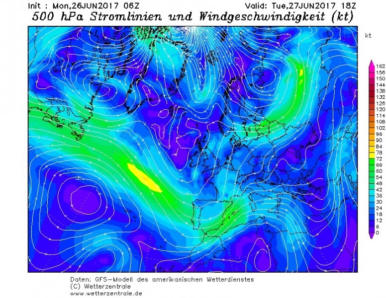
A new long wave trough pushes into western Europe later today , bringing further destabilization of weather in the region. A
round of severe thunderstorms is expected over southern France and
possibly northeastern Spain.
500 mbar winds and height, GFS model guidance. Map: Pivotal Weather.
A strong 50-70 kt mid-level (500 mbar) jetstreak will
move across the region. The surface airmass will be very warm and
humid, with high resolution models indicating temperatures around 27-32
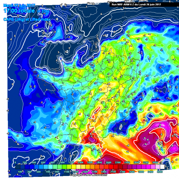
°C and dew points in 16-19 °C range across southern France. Moderate
instability will build up, with MLCAPE generally 1000-2000 J/kg.
500 mbar winds and height, GFS model guidance. Map: Wetterzentrale.
Instability across the region, WRF model guidance. Map: Meteociel.fr.
Severe thunderstorms are expected across southern
France as the left exit region of the jetstreak passes across the region
in the afternoon. With up to about 40 kt deep-layer shear and locally
fairly high SREH3 values around 200 m2/s2, organized thunderstorms,
including supercells are expected. Main threats will include large,
locally very large hail, severe wind gusts and torrential rainfall.
https://www.facebook.com/severeweatherEU/?hc_ref=PAGES_TIMELINE&fref=nf


No comments :
Post a Comment